The International Symposium for Digital Earth is one of the world’s largest and most important events using digital images of our planet to make current and societal problems measurable, understandable and solvable. In a unique way, the symposium builds bridges between politics, science and society, and also purposefully invites companies and NPOs. For the first time ever, the symposium took place in Austria. Organizers of the event from July 6-8, 2021 were the University of Salzburg and the Department of Geoinformatics – Z_GIS.
As part of ISDE12, the Data Intelligence Offensive (DIO) hosted a forum for exchange and debate on the topics of the emergent data economy and the challenges for politics and business to implement the technically feasible solutions for the benefit of society, the environment and nature – as formulated in the UN’s 17 Sustainable Development Goals – in accordance with the strictest ethical and legal standards. Topics included presentations of the Austrian data strategy, current projects on the intelligent use of data in innovative GIS application areas, lightning presentations of solutions offered by start-ups, discussions on the development of GIS data spaces, and various exchange formats with international experts and researchers. In the spirit of ISDE12, the DIO Forum was designed to build bridges between politics, science and society.
Insights into the Data Driven Intelligence Forum
Data Driven Transformations: Data Exchange and Trade – DIO President Günther Tschabuschnig (ZAMG)
Günther Tschabuschnig, CEO of Data Intelligence Offensive and CIO of ZAMG, explained how everyone claims that data is the new gold or oil. However, this is not true. It is a poor comparison actually. If data was the new gold or oil, why do we not treat it like a very wealthy resource? Our mistake is, according to Günther Tschabuschnig, that instead of using our data treasure, we hide it/ store it in the basements, where no one will ever find them. Not infrequently the data sharing or data trading fails due to lack of knowledge, experience or fear.
This is where DIO counteracts: With the help of data spaces and data circles, DIO wants to help members and the public transition to the data economy, deploy and optimize relevant technologies, build markets, and manage data with security and confidence – in compliance with data protection and data sovereignty. He also mentioned how trust, is a key element in this transition.
Real World & Environment Digital Twins: Bridging large scale 4D IoT, BIM and 3D GI – Manfred Mittlböck (RSA FG iSPACE)
Dr. Manfred Mittlböck, director of the Research Studio iSPACE Smart 4D Environments, is an expert on digital twins, especially in the relationship between real world and digital twins. In his keynote, he explained how to bring large scale 4D IoT, building information modeling and 3D geoinformatics together.
The question is, according to Mittlböck, if the real world can be a digital twin as the digital twin selves – as we state – are only digital representation of real world entities or systems. We usually have common replicas of the real world. What we do not have is the idea of the digital twin of the environment. However, this is important if we are really going and creating digital representations of the real world including IoT centers, to make sure we get up-to-date insights. He further gave an understanding, of how building information models, digital elevation models and 4D simulations depend on the availably of merged data as well as input, on how this is achievable.
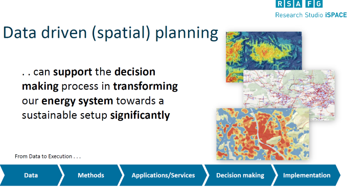
Data Driven Spatial Planning: Transformation of Energy System – Markus Biberacher (RSA FG iSPACE)
Markus Biberacher is a key researcher at the iSPACE studio Smart Settlements Systems, specialized in energy system modelling and works on energy balancing models. He investigates the supply and demand in terms of energy in areas where the energy sectors are integrating – where there is a shift from a centralized system to a partly decentralized system.
“Our current energy system”, Biberbacher explained, “grounds on nuclear and fossil fuels. We assume that in the near and mid-term future, our energy system ground on renewable resources. This can lead towards a globalization – in terms of electricity support – or regionalization – within the heating sector. Electricity is easy to transport over large distances but cannot be stored. Heat on the other side, is not suitable for transportation over large distances, however, it can be stored.”
He further explained, that on one hand, we know the potentials of renewable energy and on the other hand, we are aware of the demand we need to cover. In-between we have the conversion of transport and storage that has to be considered. All these links in-between can have a significant impact on an optimal system set up. In addition, all these parts are modeled with data. Biberbacher explained, “We can outline solar potential with geographical data then outline heat or power demand densities and optimize the infrastructure in-between.”

Smart Mobility – Martin Loidl (Univ. Salzburg Z_GIS)
Martin Loidl, researcher at Z_GIS, Department of Geoinformatics, University of Salzburg gave us an understanding of the development of Smart Mobility.
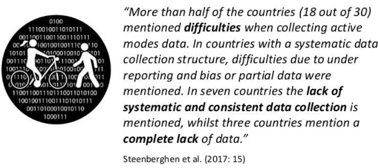
He explained that, mobility is one of the major application domains, where data crucial for innovation, transformation and for addressing SDGs are collected. He stated that one needs to care about active mobility as a major contribution to reaching sustainability goals.

However, until after modernization, mobility data acquisition was very car-centric and ignored cyclist and pedestrian. Nowadays a turnaround can be observed, that is rooted in the phase, where SDGs are guiding principles for policies. This shift is also reflected in mobility data acquisition. In any case, data will be necessary for providing evidence in the evaluation of implemented measures. Since “only measurable things count”, we need to create visibility for cyclist and pedestrian and respect them as central part of strategies, in order to promote sustainable mobility. Martin Loidl further explained why he is optimistic about data usage for sustainable mobility.


